
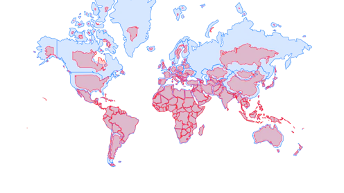
La résolution de l’ONU, présentée par un groupe d’États africains, remédie à 450 ans d’injustice cartographique en reconnaissant les distorsions engendrées par la projection de Mercator.
- Professor in Geography, Concordia University
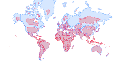
The resolution, submitted by a group of African states, corrects 450 years of cartographic injustice by recognizing the distortions produced by the Mercator projection.

Historically, western corporate maps have been privileged over Indigenous ones. But given the essential debate of territory in resource conflicts, maps are a crucial tool.
Contact Sébastien for
- General
- Media request
- Speaking request
- Consulting / Advising
- Research collaboration
- Research supervision
- Location: Canada
- Website
- X (formerly Twitter): @geomedialab
- Article Feed
- ORCID
- Joined
