
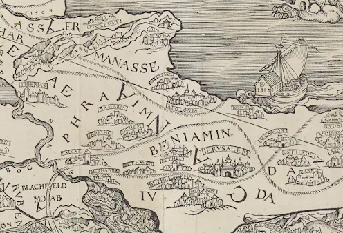
L’apparition de la toute première carte dans une Bible, au début du XVIᵉ siècle, a profondément transformé la manière de représenter la Terre sainte – et, plus largement, le monde.
- Professor of the Interpretation of the Old Testament, University of Cambridge
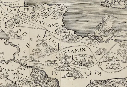
The map of the Holy Land in Christopher Froschauer’s 1525 Old Testament has the Mediterranean to the east of Palestine instead of to the west.
Contact Nathan for
- General
- Media request
- Speaking request
- Consulting / Advising
- Research collaboration
- Research supervision
- Location: Cambridge, United Kingdom
- Article Feed
- ORCID
- Joined
